
Kahului Neighbor Record Layers
A block lookup should answer one narrow question at a time. County GIS establishes which parcels are next door. Real Property Assessment records identify assessed owners and mailing addresses. Permit files show work tied to a parcel. Election law exposes only limited voter facts, and organization directories show groups rather than households. None is an unrestricted list of Kahului neighbors.
The most reliable method keeps every result tied to its source and date. A parcel owner may live elsewhere. A permit applicant may be a contractor or agent. A group named in old planning testimony may no longer operate. The block table makes those boundaries clear before any names are compared.
| Source | What It Shows About a Block | Access |
|---|---|---|
| Maui parcel viewer | Target and adjoining parcel polygons, TMKs, and map context | Free online map; click each parcel |
| RPA property roll | Assessed owner, situs, mailing address, value, and parcel facts | Online search, extracts, and RPA office |
| County public documents | Permits, plans, project files, maps, and parcel-history links | Online TMK forms; department fallback |
| Voter records | Public name, district or precinct, and voter status | Statutory limits and County application |
| Resource Directory | Listed organizations filtered by category and place | Online discovery index; verify with group |
| Historical sources | Dated subscribers, households, streets, and institutions | Library, archives, maps, and newspapers |
Start with the map, then verify one parcel at a time. This bounded approach prevents a postal ZIP, street label, or owner mailing address from being mistaken for the immediate Kahului block.
Map Kahului Neighbor Parcels
The County Parcel Viewer supports map search, panning, and parcel selection. It does not have a confirmed automatic radius report in the research. Build the set manually by selecting the target polygon and every polygon that shares a side, rear line, or relevant corner. The TMK, not a person's name, is the stable join key.
- Normalize the starting address and locate it in the County parcel map.
- Click the target polygon and save its TMK and situs address.
- Click each adjoining polygon, recording one TMK per row without inferring who occupies it.
- Open each TMK in the RPA roll to capture the assessed owner and owner mailing address as separate fields.
- Check deeds or permits only when a specific parcel question remains, and preserve the record date.
For a full named-street chain rather than the immediate block, use the Kahului directory by street. That broader task follows all parcels along the road, while this method stops at the chosen block.
Kahului Neighbor Owners
The Maui property-search FAQ documents searches by location address, TMK, owner name, map, sales search, and sales list. The captured page below gives the official entry points and helps a reader choose the address or parcel route for nearby lots.
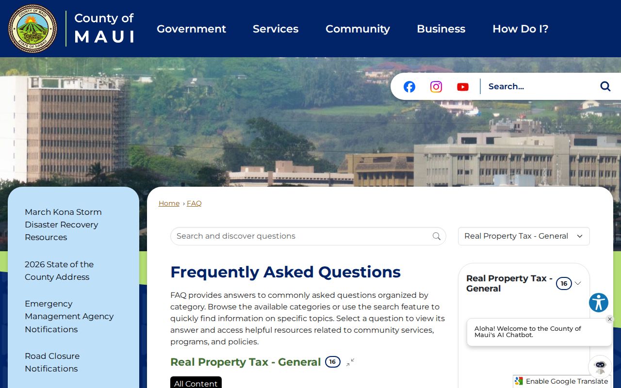
Copy the situs and owner mailing fields separately. Situs means the physical property address. The mailing field is where tax notices go and may be a post office box, agent, company, or address off island. A matching mailing and situs address may support an owner-occupancy clue for that dated record, but it does not identify family members or other occupants.
- Parcel
- A mapped unit of land identified by a TMK.
- Situs address
- The physical address assigned to the property.
- Owner mailing address
- The delivery address used for assessment or tax correspondence.
- Adjacency
- A map relationship between parcels that touch; it is not a list of people.
Kahului Neighbor Permit Context
Permits can explain construction, additions, inspections, subdivisions, and project activity around a block. The Maui issued-permit search exposes address, city, owner name, permit type, and permit number fields. The saved screen below shows the official search surface assigned to this neighbor page.
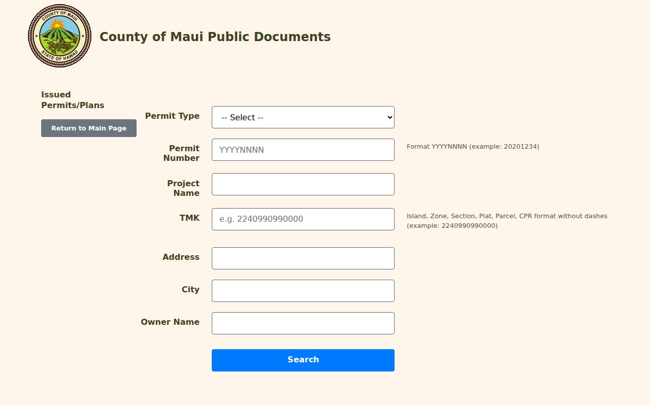
Search once by address and again by TMK through the broader public-document menu. MAPPS is the primary permit system for records from April 18, 2022 forward, while legacy records may be incomplete online. Save the case or permit number, project name, owner or applicant field, document date, and any missing-attachment notice. Call the responsible department or request a specific existing file when the portal fails.
Note: A project name, contractor, applicant, or owner on a permit does not prove that person occupies the Kahului address.
Kahului Neighbor Voter Limits
Hawaiʻi law does not turn the voter roll into a public block roster. HRS §11-97 makes a voter's full name, district or precinct designation, and voter status public. Other affidavit data is confidential except under election or government-purpose rules. Party registration is not part of Hawaiʻi voter registration.
The online voter system is built for a person to register, update, or verify personal status. It is not a name-and-address search for neighbors. Maui County has a voter-data affidavit for approved uses. At minimum, residence and mailing addresses may be supplied for an approved election purpose, while Social Security numbers, driver's-license or state-ID numbers, email, phone, and birth date are not ordinary public fields. Do not publish a block list from such data.
Privacy rule. Use the public voter fields for a specific lawful question. Never treat restricted election data as a neighborhood directory.
Verify Kahului Neighbor Groups
Community sources can add a civic layer, but the research did not locate a current official Kahului association directory, contact roster, or boundary map. County testimony from 2020 reported that Kahului lacked a community association that regularly met and represented the community at that time. An older Maui MPO stakeholder list named Kahului Town Association and Maui Lani Community Association. Both findings are dated leads, not proof of current operation or membership.
Maui County Resource Directory
Search listed organizations by category, name, city, state, or ZIP. Confirm the listing date and contact directly.
County Planning Records
Check current meeting minutes, testimony, stakeholder lists, and project records for a group's recent public role.
DCCA Business Records
Verify an entity name and public filing status before describing an association as active.
Kahului Hongwanji offers a historical community anchor. A County resolution dates the institution to 1910 or 1911, which can guide newspaper, directory, cemetery, and archive research. The historical mention does not establish anyone's membership, attendance, faith, or current tie.
Kahului Postal and Parcel Neighbors
USPS delivery geography, Census CDP limits, and County parcel lines answer different questions. Kahului is a Census Designated Place, not an incorporated city. A Kahului mailing label does not prove that a parcel is inside the CDP, and two addresses in the same ZIP are not necessarily close. Nearby Puunene and Wailuku labels can further complicate a search.
Use USPS only to normalize the deliverable address. Use County GIS to decide whether parcels share a boundary. Use the Census map only when a statistic or CDP boundary matters. This three-way check prevents a postal neighbor from being presented as a next-door parcel owner.
Note: Save the exact locality from each dated source instead of replacing it with a modern Kahului label.
Kahului Neighbor Record Results
Commercial neighbor tools often merge addresses, phone data, and names without showing the record date or custodian. Official records are narrower, but they state what was filed and who keeps it. That makes the official path easier to audit when two names conflict.
| Method | Useful Strength | Important Limit |
|---|---|---|
| County and state records | Dated parcel, deed, permit, voter-status, or filing facts | No complete occupant list; separate offices and access rules |
| Commercial category | Fast hints compiled from many sources | May be stale, merged, costly, or unclear about origin |
| Community listings | Current public contacts when the group maintains them | Not a census of residents or proof of membership |
Use a commercial result, if encountered, only as an unverified lead. Confirm any property fact with RPA or BOC, any permit fact with the County file, and any organization fact with the group or current government record.
Privacy for Kahului Neighbors
Public parcel data omits renters and many household members. Utility customer lists were not located as public records. The Hawaiʻi Address Confidentiality Program supplies substitute addresses and protects actual addresses for qualifying survivors of domestic abuse, sexual offenses, or stalking. Stop a search when a protected address or safety concern appears.
The state's covered-offender registry is conviction-based and carries a warning that it does not guarantee public safety. It should not be treated as a general list of neighbors or used to threaten anyone. For a specific personal-safety question, follow the official registry terms and confirm the record with its custodian.
Lawful use. Neighbor research is for learning about a block, civic contact, or personal safety. Never use it to watch, harass, intimidate, or harm anyone.
Confirm Kahului Neighbors Offline
When a parcel, permit, or community listing is missing online, contact the office that keeps that source. RPA can help identify a TMK, Planning and Public Works can locate their own case files, and the library reference desk can check older directories or newspapers. A focused UIPA request may seek an existing map, permit, or dated roster, but it should not ask Maui County to create a new list of people on a block.
Record each source date and respect an Address Confidentiality Program substitute address. An offline check should narrow uncertainty, never become an attempt to expose someone who chose lawful address protection.